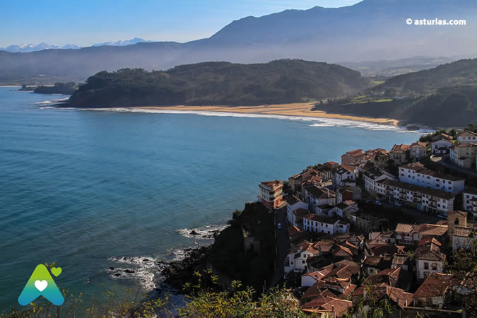
It is known that during the Late Jurassic, Asturias had an extremely arid climate, and its coasts were low, initially lacking cliffs. A vast marshland left behind traces, both large and small, of all the organisms that survived in that environment. Dinosaurs , in particular, found in this mud , which was also home to numerous river deltas, an ideal place to meet their survival needs.
Now, many of the finds and numerous replicas of animals from that era can be seen in one of Asturias' most visited museums: the Jurassic Museum . Its founding collection comprises more than 8.000 fossil specimens exclusively from the Asturian Jurassic period. The research is being carried out by a team led by José Carlos García Ramos, Professor of Geology at the University of Oviedo.
Jurassic Museum - MUJA
In a privileged location on the Asturian coast, just a few meters above sea level, lies … Read more
The dinosaur coast
A dense coastal strip stretching over 60 kilometers serves as a study material for researchers. This natural archive, in this area, is arranged in a series of gigantic slabs that make up what geographers call stratigraphic formations. The precise limits of the Jurassic period on the Asturian coast, which contain these formations, extend from Cabo Torres , west of Gijón, to the Arra rocky outcrop , two kilometers east of Ribadesella (two major faults serve as the exact boundary with the older rocks of another type of coastline that dates back further, to the Paleozoic).

The Mesozoic Era occupies a substantial portion of the materials in these layers. Footprints of branchiopods, saudopods, theropods, and others—both bipedal and quadrupedal, carnivorous and vegetarian —are the most abundant, with measurements ranging from the footprint of a pigeon to ten times the size of an elephant's. But in this privileged area of the Iberian Peninsula's coastline, remains of turtles, crocodiles and marine reptiles, fish, plants, tree trunks, small organisms, Jurassic wave imprints, traces of streams from that era, and countless other traces are also found.
Five different types of geological formations have been cataloged . None of them are mutually exclusive, as they are theoretical models.

The Gijón Formation is the oldest (between 206 and 199 million years old), is located at a height of over 100 meters and is abundant in limestone and fossils of bivalves and gastropods.
The Rodiles Formation is 25 million years younger; here, reptile and fish bones appear, in addition to invertebrate fossils.
The Vega Formation is over 150 meters thick, transitioning from limestone to gray sandstone and red shale. It dates back to before 154 million years ago. Here we find small crustaceans, plant remains, footprints, and dinosaur bones.
The Tereñes Formation is even younger and dates back to the time when Asturias was a kind of muddy inland sea.
Finally, the Lastres Formation, the youngest of the five at 151 million years old, is also very rich in fauna and flora finds. During this period, Asturias had a more developed landscape, populated by small river deltas, marshes, and swamps.
What dinosaur footprints will we find?
Although there are numerous excavations and discoveries, the main attraction of the Asturian Jurassic coast lies in the extraordinary number of ichnites (fossilized footprints). The density and variety of these footprints are very rare elsewhere. In addition to the classic depressions in the rocks, there are also the abundant "counter-molds ." These are clear footprints that face upwards, the result of subsequent sedimentation that covered them over time.
The walking routes that we propose below could be frustrating if you do not have a guide, hence some minimal descriptive notes are necessary to avoid overlooking the trails:
1/ The shape of the footprints we find depends on four main factors: anatomy (foot shape), substrate (sediment conditions), behavior (speed, balance of the animal, etc.), and preservation. Therefore, it's not advisable to look for the typical, perfectly defined and marked three-toed footprint.
2/ Types of dinosaurs. Based on their mode of locomotion, they can be classified as bipeds and quadrupeds.
The earliest dinosaurs, such as theropods and most ornithopods, walked upright. Quadrupeds, like sauropods and those with horns, plates, and armor, used both their forelimbs and hindlimbs. Generally, the tracks of quadrupedal dinosaurs are wider than those of bipeds due to their different body structure. Among quadrupedal dinosaurs, sauropods are the most common; their footprints are circular or rectangular, while their handprints tend to be crescent-shaped. Both theropods and ornithopods generally produce bipedal tracks, consisting of tridactyl footprints. Distinguishing between the two types of footprints is not always straightforward, but theropod footprints tend to be more slender, with longer, narrower toes.
Walking routes along the Jurassic coastline
The main road access to the Jurassic sites in Asturias is via the Cantabrian Highway ( Autovía del Cantábrico ) on the eastern side of the Principality, passing through Ribadesella, Caravia, Colunga, and Villaviciosa, as well as the C-256 regional road and the N-632 national highway , which we will necessarily have to use at some point to get closer to the coast. These are the main sites discovered to date:
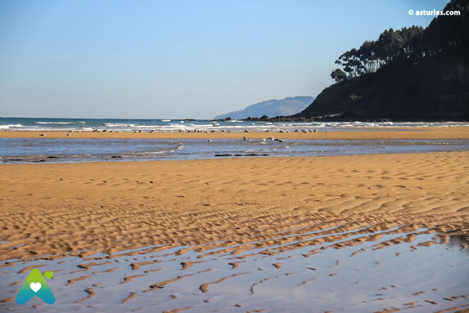
Merón Beach Villaviciosa
There are two alternatives, one is taking the detour from the As-256 regional road to Careñes, where you have to leave the car and take a descending path that starts from the town church in the direction of the beach [900 meters]. The other part of the Argüero deviation, following the signs indicating the beach.
From there, the route begins westward along the base of the cliff for about 600 meters until reaching a sandstone stratum of the Lastres Formation. On its surface, the trail of a sauropod (quadruped) is preserved, consisting of 12 consecutive hand and foot prints . There are also scattered tridactyl footprints of bipeds.
Cliffs of Oles Villaviciosa
Starting from the regional As-256, at the height of El Gobernador, take the deviation that leads to Oles and Tazones. Upon reaching the first of these two towns, a very narrow paved road starts on the left and heads north, passing in front of the parish church of Oles, where there is a small parking lot to leave the vehicle. From there, a path begins that must be followed for 900 meters until it joins a path after a 90-degree turn to the west, which ends just above a broad stratum of sandstone slightly inclined towards the sea.
There are 12 tracks of bipedal dinosaurs oriented in various directions . The rocks belong to the Lastres Formation and include several sandstone strata with undulating surfaces due to Jurassic water currents and waves.
Tazones Villaviciosa Lighthouse
The explanatory panel is located at the beginning of a path that starts on the left side of the road that leads to the lighthouse. Following the signs you access the cliff after a journey of 1.300 meters.
There, on a slab of rock slightly inclined towards the sea, lies the first three-toed dinosaur footprint . From here, continuing to the right (east), one reaches the surface of a sandstone stratum, inclined about 25 degrees towards the sea, which displays numerous three-toed footprints that intersect in various directions and form several tracks, as well as a tail drag mark. This is a rare example in the fossil record, since, contrary to what was thought until recently, dinosaurs walked with their tails held upright to maintain their balance.
In adjacent strata with the same orientation, various ichnites of hands and feet of quadruped dinosaurs are also observed , seen in plan view, as well as the vertical section of one of them of large dimensions, probably of a sauropod.
Another 60 meters further in the same direction, on the vertical wall of the cliff, you can see ichnites of quadrupeds with sandstone filling as bulges at the base of the subhorizontal strata of the same composition or isolated inside gray marl.
Tazones Beach Villaviciosa
There is an information panel on Tazones beach. Starting from the panel itself, follow the beach and the cliff; about 120 meters away, on the surface of a gray stratum inclined at approximately 45 degrees, you will see several tridactyl footprints belonging to bipedal dinosaurs , oriented in various directions. Some of them form a trackway.
If we continue for about 480 meters in the same direction, and already within the Vega Formation, of fluvial origin, another tridactyl dinosaur footprint can be seen forming a countermold at the base of a sandstone projection as an eave located several meters high. .
Puerto de Tazones Villaviciosa
On the cliff at the western end of Tazones, a few meters past the port's breakwater, a magnificent example of a vertical fault can be observed within an alternating succession of sandstones, shales, and marls. A few meters further on, several examples of vertical root imprints surrounded by a pale green halo can be seen against a reddish rock background, representing Jurassic paleosols.
Lastres Colunga Cliffs
From the coastal road N-632 at Colunga, take the regional road As-257 that leads to Lastres. After passing this town and after traveling 1,5 kilometers you reach Luces, where you take a detour to the right along a narrow paved road that leads to the Lastres lighthouse. About 650 meters before reaching the lighthouse, a path starts straight ahead along which we must travel about 850 meters to the foot of the cliff.
Nearby, and slightly to the east, lies a loose block of sandstone with two counter-molds of dinosaur footprints: one a three-toed footprint of a biped and the other a crescent-shaped footprint of a sauropod . Following the base of the cliff westward for about 300 meters leads to sloping sandstone strata containing several three-toed footprints and a sauropod trackway, the latter quite worn by the action of the sea.
Numerous fragments of fossilized Jurassic tree trunks up to 50 cm in diameter can also be observed .
Greek Colunga Beach
Playa de la Griega can be reached from the N-632, turning off towards Colunga and then taking the road that leads to both Lastres and La Griega beaches. To reach La Griega, however, you need to take a road to the right. There is an information panel on the right bank of the estuary, immediately after crossing the bridge, very close to the campsite. From there, continue towards the cliff on the eastern side of the beach.
About 500 meters from the explanatory panel, on the surface of a loose block of red sandstone, appear two decimeter-scale protuberances that correspond to counter-molds of a handprint and a footprint of quadruped dinosaurs , oriented in opposite directions.
Continuing along the same cliff edge for another 150 meters, one reaches a gently sloping sandstone stratum that slopes towards the sea. Its surface is crisscrossed by joints (tectonically formed cracks) running in various directions. Less than a meter above this lies a gray limestone containing tiny gastropod fossils and several large, rounded depressions (up to 1,3 meters in diameter).
These are footprints of large quadrupedal dinosaurs, characterized by a prominent peripheral rim. They are the largest footprints in Spain, and their size places them among the largest in the world . The dinosaur that produced them must have been a colossal specimen, a gigantic quadrupedal sauropod whose weight could have reached around 100 tons. In addition to these footprints, a trackway formed by six footprints can be observed, also belonging to a smaller sauropod.
Laterally and on the same surface, other tridactyl ichnites appear that form a trail that is somewhat more difficult to identify. About 30 meters further on, some red sandstones from the Vega formation can be seen, which contain traces of pale green verticalized roots, corresponding to ancient paleosols located in areas lateral to the bed of a Jurassic river. The distance between the explanatory panel and the end of the itinerary is about 600 meters.
Vega Ribadesella beach
Access from the N-632 coastal road is located around the town of Torre, about 6 kilometers east of Ribadesella. From there starts a 1,8 kilometer paved road that leads to Vega beach.
Just a few meters from the eastern end of the parking lot, formations containing abundant marine fossils are visible. Above them lies a one-meter-thick layer of conglomerate composed of siliceous pebbles; eight meters above this is a sandstone stratum at the base of which are several tridactyl footprints of bipedal dinosaurs . The geological composition is typical of this Vega formation, which is predominantly of fluvial origin. It is not easily accessible.
Cliffs of Tereñes Ribadesella
Take the road up to Tereñes until you reach a high point where it makes a sharp left turn at a crossroads. From here, where the information panel is located, take a narrow road that descends gently for 200 meters. A path to the right leads to the cliff. Along this particular stretch of coastline, an inland sea once gently lapped, protected from the rougher waters by a geological formation acting as a dike.
Once there, the route begins from right to left [westward]. Various dinosaur tracks can be observed, among which three stand out: two from bipedal and tridactyl dinosaurs, and another very spectacular one from quadrupeds, showing hand and foot prints. They are located on a flat, sloping rock, as is typical in these cases. The first scientific survey of these tracks concluded that they were "dinoturbation," meaning a mass of randomly distributed footprints resulting from a massive influx of dinosaurs of all kinds in the same location.
However, the theory has recently changed. If we analyze the stride length, the size of the tracks, and their orientation relative to an axis, we discover—surprisingly, and this is a finding of great importance in the continental Europe of the dinosaurs—that the tracks are parallel to each other, with an astonishing symmetry that tells us that those "monsters" walked in herds through that area, taking a leisurely stroll and displaying their gregarious behavior.
Most of the footprints belong to herbivorous bipeds, although it's striking to see another, different trackway extending perpendicularly towards the first set of tracks at the very top of the rock. These tracks have sharper toes and belong to carnivorous bipeds, the kind that commonly preyed on the herd. Thousands of years may have passed between the footprints of the herd and those of the carnivore.
In a small cove about 90 meters southwest of the Forno rock there is a block of reddish sandstone fallen at the foot of the cliff in which there are small tridactyl footprints created by bipedal dinosaurs.
The total route along the base of the cliff that contains the main ichnites as well as very striking examples of Jurassic desiccation cracks is about 400 meters.
Ribadesella beach
At the western end of Santa Marina beach, at the end of the viewpoint known as Mirador del Pozu, there is an information panel . Looking south, you can see gray Carboniferous limestone formations that stand out against the vertical cliff face.
Near the end of the walk, we find an alternating layer of marl and limestone with interbedded sandstone, which extends westward along the cliff. It displays several layers rich in very small bivalves, as well as desiccation cracks and frequent dinosaur footprints . These appear on the surface of the strata as oval or tridactyl-shaped depressions.
On the same descent to the cliff from the viewpoint at the end of the walk you can see some of these footprints. From here and continuing about 150 meters to the west along the base of it, there is a large slab of sandy limestone inclined to the sea at about 80 degrees. On it there are several traces of sauropod [quadruped] footprints.
Text: © Ramón Molleda for asturias.com